
The research project "Volunteering for Climate Adaptation and Disasters in the Indian Sundarbans" is led by Professor Matt Baillie Smith which was initiated in partnership with Jadavpur University as part of the UKRI-GCRF Living Deltas Research Hub wider collaborative project.
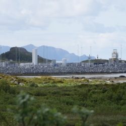
The project focuses on the context of the Indian Sundarbans (Indian part of the Ganges‐Brahmaputra‐Meghna Delta) and Kolkata city, located in the Indian state of West Bengal, to generate new evidence on the ways individuals and organisations mobilise labour in their approaches to disaster response and climate adaptation.
It aims to understand the everyday ways delta dwellers undertake voluntary or unpaid work to respond to disasters and or the changing environment and how this work is organised. It also explores the unpaid and voluntary labour of individuals and groups outside the Sundarbans in contributing to crisis response and responses to the changing climate, and how their labour impacts those present in the Sundarbans to build sustainable delta futures.
The research has the following objectives:
- To conceptualise the different kinds of voluntary labour mobilised for climate adaptation and disasters response in the Indian Sundarbans.
- To analyse the different ways voluntary labour is managed and governed in strategies for adaptation and crises response by the civil society and private sector.
- To assess the impacts of voluntary labour on adaptation, climate response and participants’ lives.
- To increase understanding and awareness of the role of voluntary labour in crises response and adaptation.
- To increase understanding of the importance of voluntary labour in climate adaptation strategies and disasters in the Indian Sundarbans, and beyond, providing evidence and insight to support improvements in policy and practice.
The project’s activities involve qualitative and participatory
visual research methods to engage with a diverse set of stakeholders in the Sundarbans
region and Kolkata, including current and former
volunteers, regional and local grassroots level organisations, private sector
organisations and communities affected by the changing delta environment.
- Photobook: Narratives and Images from Volunteers in the Indian Sundarbans
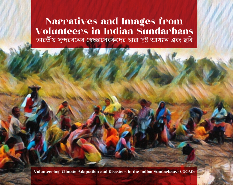
Click HERE to read and download the photobook (in English and Bangla)
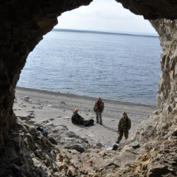
This book draws from the photos and diary entries from research participants involved with the activities of VOCAD (Volunteering for Climate Adaptation and Disasters) in the Indian Sundarbans. The photobook reveals the diverse, critical and complex roles that voluntary labour plays in the lives of delta dwellers in a region that has been deeply affected by climate-related disasters and changes to its delicate ecosystem, impacting the lives of millions.
In the opening words of Dr. Andrew Fleming, British Deputy High Commissioner to East and North East India, who endorsed the photobook:
"I am proud to introduce what is both a powerful and beautiful book, but also an important piece of research built on a strong UK/India collaboration. I hope the insights shared here can be widely disseminated and contribute to ensuring we do all we can to protect fragile but vital ecosystems such as the Indian Sundarbans".
- Interactive game
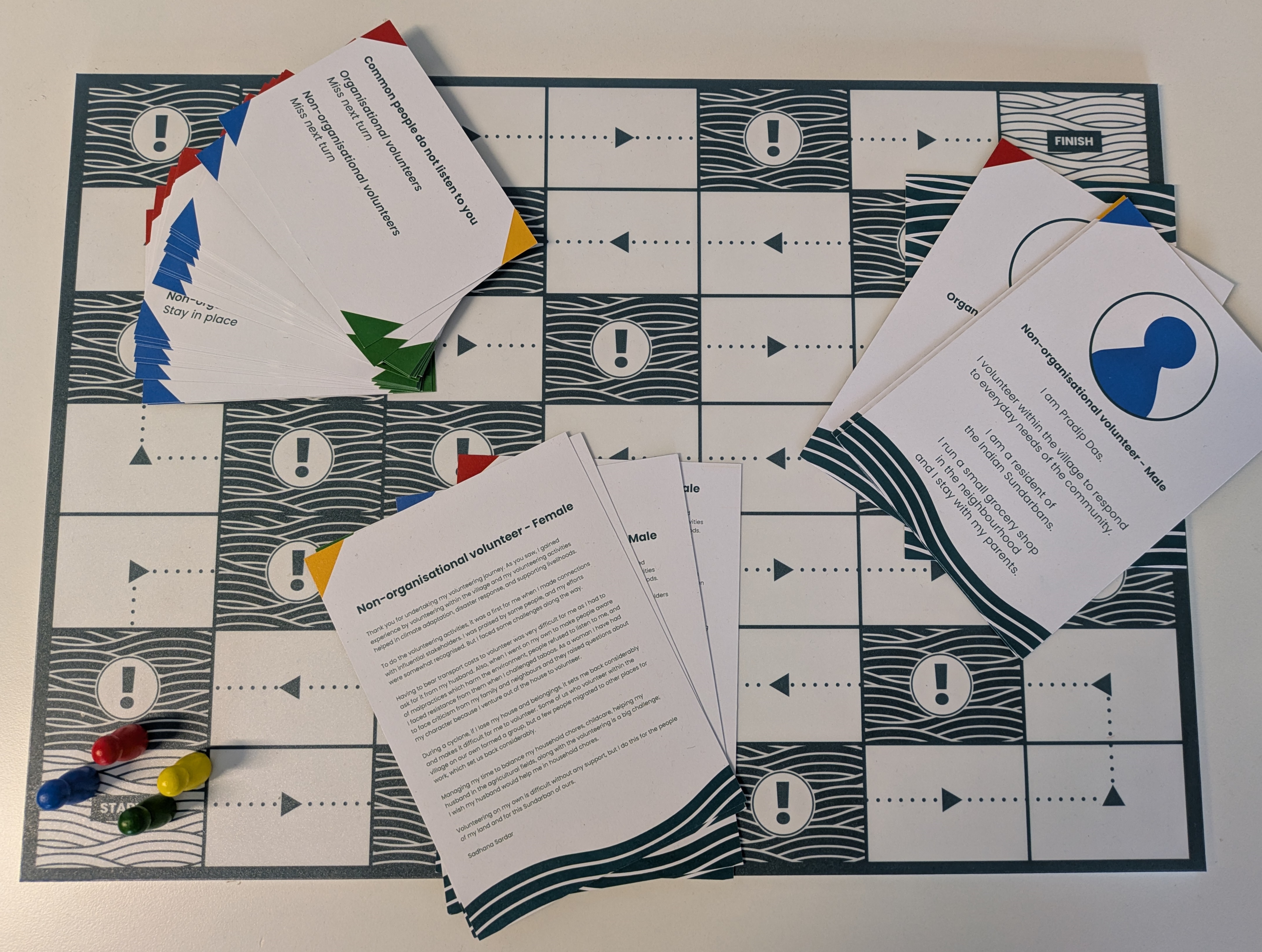 Click HERE to download and print the VOCAD game in English
Click HERE to download and print the VOCAD game in Bangla
This interactive game was developed as part of the VOCAD research to enhance policy and practice by increasing awareness of the complex and varied journeys of volunteers working at the forefront of climate change. It is an interactive tool allowing players to simulate real-world scenarios, bringing to life some of the key findings from the VOCAD research on volunteering in the context of the climate emergency. Through an engaging journey, the game highlights the challenges encountered by volunteers and the opportunities that unpaid labour can offer to those living in the Indian Sundarbans.
All resources are free and can be downloaded in English and Bangla through the links above (we recommend printing on both sides in colour).
To play the game, you also need four tokens/pins for the players to move around the board game (the tokens/pins can be made of paper, ideally in the players' colours - blue, green, red, yellow).
- Exhibit booklet: “Beyond infrastructures and disasters: voluntary labour and climate change in the Indian Sundarbans”

Click HERE to read and download the VOCAD Exhibit booklet
This exhibit booklet shares findings from research on voluntary labour by communities who live in the Indian Sundarbans in the Ganges-Brahmaputra-Meghna delta, an area facing significant threats and disruption from climate change. By prioritising their voices and experiences, we learn how volunteering in the context of climate change is about more than building and maintaining climate infrastructures or responding to disasters. It is entangled with the ways societies are being changed and challenged by climate change. And volunteering is itself being changed by climate change.
- Research Impact Summary
As a part of the UKRI-GCRF Living Deltas Hub, the VOCAD project explores the everyday ways that delta dwellers in the Indian Sundarbans undertake voluntary or unpaid work to respond to disasters and adapt to their changing environment, and how this work is organised. The main focus of this impact summary is to provide insights from the individual research participants, representatives of the organisations taking part in the research, and community members attending the introductory workshops and exhibitions in the Indian Sundarbans.
Click HERE to read and download the VOCAD Research Impact Summary
First, the summary explores the question: “How did VOCAD impact research participants?” highlighting the following areas of attention:
- Shifts in the value and perception of voluntary labour
- Increased networks, peer support and solidarity
- Challenging gender norms
- Development of new skills and experience
- Increased reflective capacity
- Informing career direction
Second, the summary looks into the question “How did VOCAD impact participating organisations?” through the following areas:
- Recognition of the importance of voluntary labour
- Greater insights about volunteers’ experiences
- Need to recognise voluntary labour in policy design
Finally, in response to the questions “How did VOCAD impact other organisations attending the exhibition?” and “How did VOCAD impact organisations attending the introductory workshop?” the following areas are explored:
- Insight into the importance of voluntary labour
- Greater insights about volunteers’ roles and responsibilities
- Novel research objective
- Opportunity to meet new people and co-learn
- Call to Action
Click HERE to find out more about the call to action
“Recognise, value and manage the diverse forms of voluntary labour undertaken by communities in adaptation and disaster response to ensure it is not exploitative and supports sustainable delta futures.”


Why this is important:
- Voluntary labour by
delta communities plays critical roles in government and civil society
strategies for climate adaptation and disaster response but is poorly
understood and often under-valued.
- There is a focus on the
role of voluntary labour in providing physical labour for climate
infrastructures and conservation, meaning its contributions to
communities, social relations and empowerment are ignored.
- Voluntary labour can
build capacities and skills, but it can also be an additional burden for
individuals and communities on the frontline of climate change.
Priorities and steps:
Governments, civil society organisations and private
sector actors who engage volunteers should:
- Understand that the
ready availability of the unpaid labour of the poor cannot be
assumed.
- Respect and draw upon
the knowledge of community volunteers in designing strategies for
adaptation and disaster response.
- Develop knowledge and
evidence of the diverse kinds of voluntary labour already taking place in
climate affected communities and use this to inform decisions to engage
volunteers.
- Respect different kinds
of voluntary labour and their contributions, including looking beyond its
role in supporting infrastructure and conservation and recognising its
role in empowerment, challenging social norms, and building community
resilience.
- Make efforts to ensure
that that strategies for volunteer engagement address existing social
inequalities and do everything possible to make volunteering
inclusive.
- Ensure that volunteers
have opportunities to build their capacities and skills in ways that
benefit them as well as the volunteer engaging organisation.
- Ensure that voluntary
labour is not exploitative, providing appropriate remuneration, avoiding
coercion and mitigating against risks arising from volunteering.
- Recognise the gendered
differences in volunteering and tailor volunteer roles accordingly.
You can find out more about the Living Deltas Hub here and also access resources about the VOCAD research activities in the Indian Sundarbans here. For more information, please contact Prof Matt Baillie Smith, Melisa Maida or Sumana Banerjee.

Latest News and Features
Northumbria's world-leading research showcased to UK's national science funders
The governing body of UK Research and Innovation (UKRI) has visited Northumbria University…
Northumbria University appoints new Deputy Vice-Chancellor and Provost
Northumbria University has announced that Professor Andy Dougill will become its new Deputy…
Royal Honour as leading researcher awarded Polar Medal
Professor John Woodward has been awarded The Polar Medal in recognition of his outstanding…
Northumbria University leads pioneering research to tackle hidden lead exposure in children
Pioneering research launches in Leeds to test new approach to assessing the risk to children…
International students at Northumbria embark on FA Cup dream
A team of international college students studying at Northumbria University could soon find…

Northumbria expands results day support for students
Northumbria University is expanding and enhancing the support it provides to students receiving…
Supporting the ethical development of UK spaceports
A Northumbria University academic is helping to ensure the UK’s ambitions to build a thriving…
Research reveals Arctic region was permafrost-free when global temperatures were 4.5˚C higher than today
Scientists have found evidence that the Asian continent was free of permafrost all the way…
More events
Upcoming events

Northumbria University Carol Service 2026
Newcastle Cathedral
-
Page last updated 21/05/26
