-
Study
-
UCAS Clearing 2024
- Clearing Courses
- The Clearing Process
- UCAS Tariff Points
- Clearing 2024 FAQs
- Confirmation
- Clearing Virtual Event
-
Undergraduate
- Search for a Course
- Undergraduate Open Day & Events
- Application Guides
- Northumbria University UCAS Exhibitions
- Foundation Years
- Undergraduate Fees & Funding
- School & College Outreach
- Continuing Professional Development
-
Postgraduate
- Postgraduate Study Degree
- Postgraduate Research Degrees
- Postgraduate Open Days and Events
- Postgraduate Fees & Funding
- Flexible Learning
- Thinking about a Masters?
- Continuing Professional Development
- Change Direction
-
Student Life
- The Hub - Student Blog
- Accommodation
- Life in Newcastle
- Support for Students
- Careers
- Information for Parents
- Students' Union
- Northumbria Sport
-
-
International
International
Northumbria’s global footprint touches every continent across the world, through our global partnerships across 17 institutions in 10 countries, to our 277,000 strong alumni community and 150 recruitment partners – we prepare our students for the challenges of tomorrow. Discover more about how to join Northumbria’s global family or our partnerships.
View our Global Footprint-
Applying to Northumbria
- European Union
- Our London Campus
- Northumbria Pathway
- International Events
- Entry Requirements and Country Representatives
- Regional Offices
-
Northumbria Language Centre
- Faculty Requirements
- Acceptable English Requirements
- Pre-Sessional English and Study Skills
- Academic Language Skills Programmes (ALS)
-
International Fees, Funding & Scholarships
- International Undergraduate Fees
- International Undergraduate Funding
- International Masters Fees
- International Masters Funding
- International Postgraduate Research Fees
- International Postgraduate Research Funding
- International Money Matters
-
Life at Northumbria
- International student support
- Careers
-
International Mobility
- Current Northumbria Students
- Incoming Exchange Students
-
-
Business
Business
The world is changing faster than ever before. The future is there to be won by organisations who find ways to turn today's possibilities into tomorrows competitive edge. In a connected world, collaboration can be the key to success.
More on our Business Services -
Research
Research
Northumbria is a research-rich, business-focused, professional university with a global reputation for academic quality. We conduct ground-breaking research that is responsive to the science & technology, health & well being, economic and social and arts & cultural needs for the communities
Discover more about our Research -
About Us
-
About Northumbria
- Our Strategy
- Our Staff
- Place and Partnerships
- Student Profiles
- Alumni Profiles
- Leadership & Governance
- Academic Departments
- University Services
- History of Northumbria
- Contact us
- Online Shop
-
-
Alumni
Alumni
Northumbria University is renowned for the calibre of its business-ready graduates. Our alumni network has over 237,000 graduates based in 178 countries worldwide in a range of sectors, our alumni are making a real impact on the world.
Our Alumni - Work For Us


.png?h=350&w=350&modified=20231027110616&hash=026F08593FDD2B35C13A35CEB5BBC053) Dr Andrew Suggitt, an ecologist from the
Dr Andrew Suggitt, an ecologist from the 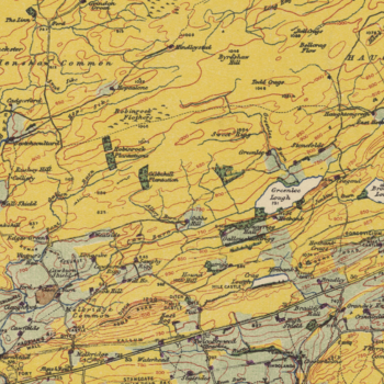 Dr Alistair Auffret, an ecologist at the
